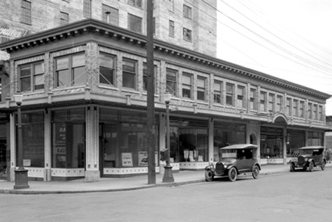
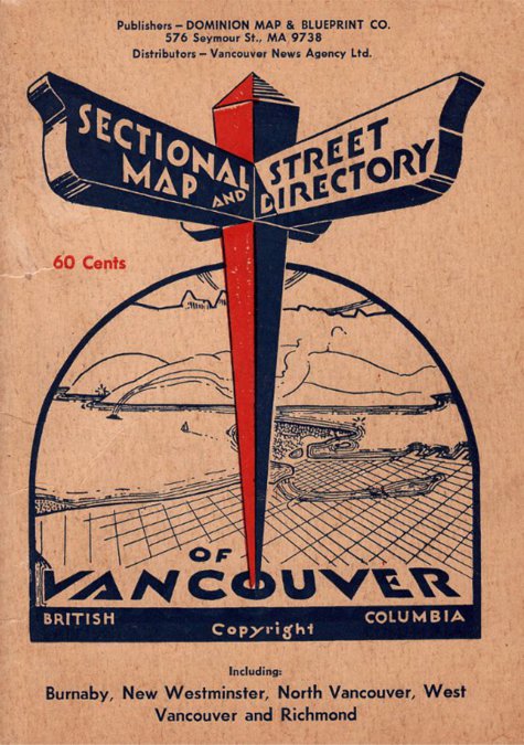
In 1912 Dominion Blue Print & Drafting Company makes its debut in the city directory. It is one of eight companies involved in blueprints. A half page ad on page 226 of the 1912 directory indicates that Dominion Blue Print & Drafting Company, located at 36 Bank of Hamilton Building (432 Hamilton St.), is a Maker of Maps, Blueprints, Brown Line, and Blue Line Prints.
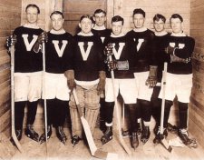 The first professional hockey game ever played in Vancouver took place on January 5, 1912, it was enjoyed by the crowd at the Patrick brothers’ Denman Arena. The Vancouver Millionaires beat the New Westminster Royals 8 to 3. In 1915, they won the Stanley Cup. The finals were played in Vancouver, with Games 1, 3, and 5 played under Pacific Coast Hockey Association (PCHA) rules. The Millionaires became the first team from the PCHA to win the Cup.
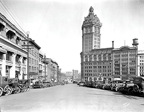
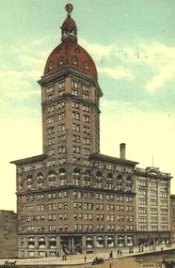 The 270-foot (82.3-metre) tall World Building went up at 100 West Pender. We know it today as the Old Sun Tower. John Coughland and Sons of Vancouver fabricated 1,250 tons of steel for what was then the tallest building in the British Empire. It held that title for two years. (The caryatids on the building, the “Nine Maidens,” were created by sculptor Charles Marega.)
On February 12, 1912 the Vancouver Morning Sun first appeared. Later, it will become an afternoon newspaper, the Vancouver Sun. When the Sun began operation, it was published at 125 West Pender Street, just around the corner from The Province, its rival at the time. In 1924, the Sun bought the Vancouver World newspaper, which had been in financial difficulty for some time. In March 1937, a fire destroyed the Sun's business and editorial offices. The only casualty was the janitor, who suffered minor burns and smoke inhalation. The Sun promptly moved across the street into the World Building, where the World had been published. The building was accordingly renamed the Sun Tower. The paper moved to Granville Square in 1997.
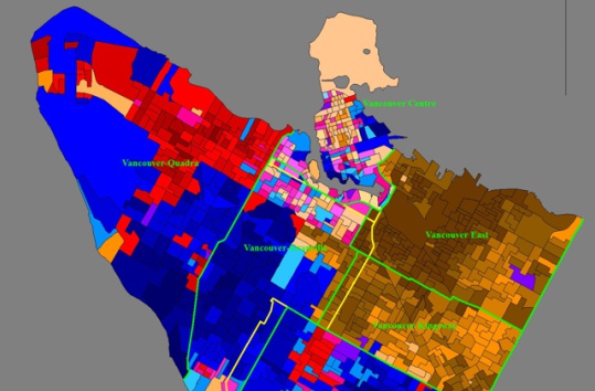
 On March 15, the municipality of West Vancouver was incorporated. The population was 700. Land for the city hall was donated by John Lawson, called by some the "father" of West Vancouver. (Population in the summers went up to 1,200.) The first municipal election was held on April 6, 1912. In November 1938, the Lions Gate Bridge was opened to traffic, allowing extensive growth of the semi-populated community, previously only accessible by ferry. Some homes in West Vancouver date back to the 1920s and 30s, though most of the currently existing dwellings were built in the 1970s and 80s, and mostly in British Pacific Properties' developments.
On March 30th the Vancouver local of the International Longshoremen's Association was formed, with 60 charter members. Also that March, Emily Carr, back from a sojourn in France, exhibits paintings she created there in her gallery at 1465 West Broadway.
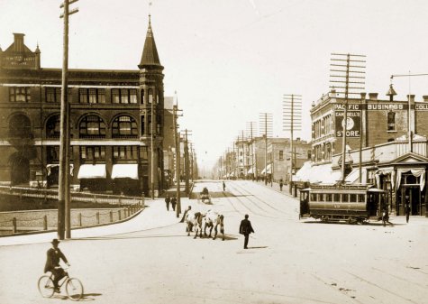
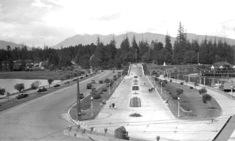
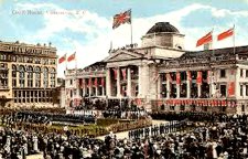 On September 18th, Canada’s Governor General, the Duke of Connaught (a famous soldier and a son of Queen Victoria), visited Vancouver with the Duchess to officiate at the ceremony naming the brand-new Connaught Bridge—a name that never caught on. Everyone called it the Cambie Street Bridge. (It was demolished in 1985, replaced by the present bridge.) The royals were accompanied by their daughter, Princess Patricia, the woman for whom the Princess Patricia’s Canadian Light Infantry (PPCLI) is named; she was the regiment’s colonel-in-chief.
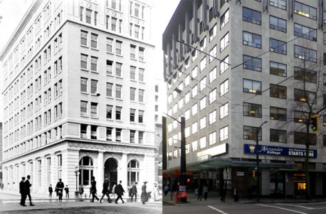
The Connaughts officially opened the provincial courthouse, too. James Findlay was the first Vancouver mayor to wear the new gold civic chain of office. That was for the royal visit.
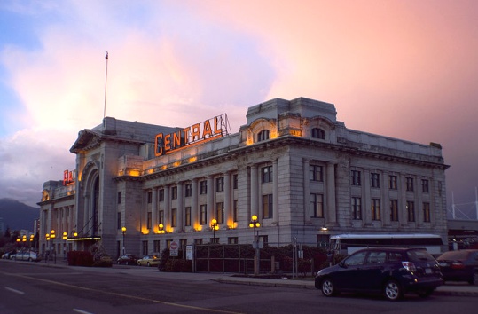
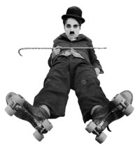 Also in 1912, the Lee Building at Broadway and Main went up. That’s the one with the huge billboard atop it. The CPR Station opened at 601 West Cordova. Contractor was Westinghouse, Church, Kerr & Co. Today the beautiful old building is the western terminus for the SkyTrain and the West Coast Express, and the southern port for the SeaBus. Charlie Chaplin and Stan Laurel performed in Vancouver with a music hall troupe from England, “Karno's Comedians.” A 250-pound Vancouver policeman, Duncan Gillis, became the first Olympic medal winner from B.C., winning silver at Stockholm in the hammer throw. (48.39 metres.)
Most of us have grown up with Oreo cookies, and 100 years ago the Oreo cookie, was born. In 1912, Nabisco had a new idea for a cookie - two chocolate disks with a creme filling in between. The first Oreo cookie looked very similar to the Oreo cookie of today, with only a slight difference in the design on the chocolate disks.
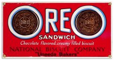 So how did the Oreo get its name? The people at Nabisco aren't quite sure. Some believe that the cookie's name was taken from the French word for gold, "or" (the main color on early Oreo packages). Others claim the name stemmed from the shape of a hill-shaped test version; thus naming the cookie in Greek for mountain, "oreo." Still others believe the name is a combination of taking the "re" from "cream" and placing it between the two "o"s in "chocolate" - making "o-re-o." And still others believe that the cookie was named Oreo because it was short and easy to pronounce.
No matter how it got named, over 362 billion Oreo cookies have been sold since it was first introduced in 1912, making it the best selling cookie of the 20th century.


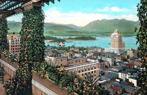
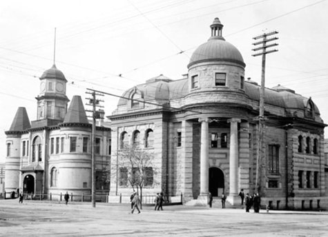
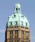 It is known for its faux-patina steel dome painted to imitate copper cladding. Nine nude muses, the "nine maidens" supporting the cornice line can be seen. The terracotta for this building, including the ladies, was made in Tamworth, Staffordshire, England by Gibbs and Canning Limited.
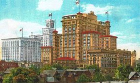
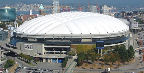
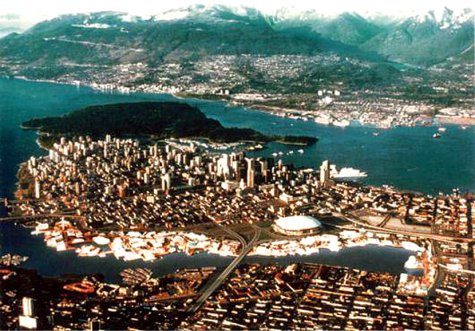
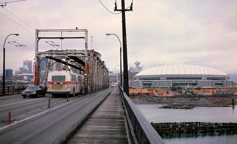
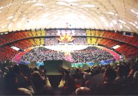 B.C. Place was used for the opening and closing ceremonies of the 1986 World Exposition on Transportation and Communication (Expo '86). Accepting an invitation by the Province of British Columbia, their Royal Highnesses Prince Charles and Princess Diana made themselves available to take part in the opening ceremonies. To great fanfare, they officially proclaimed the World's fair open on May 2, 1986.
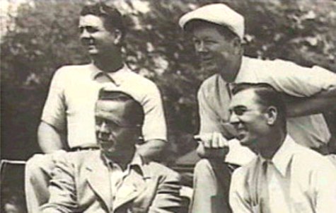
 How many professional majors, how many pro tour victories, how many world wide victories even if it's the Legends of Golf or The Skins Game? Those were our measuring sticks. Amateur championships, if added, might change the order a little bit. But that's a task for someone else at another time. These are our top 50 playing in professional events.
 Still, it doesn't make sense to give them higher standing than some of the modern players who contested over 72 holes, on great courses, with tough competition and then won in many tournaments around the world. When you see who the modern era golfers are, you'll understand the reason for putting the historic gentlemen last. No disrespect meant.